Tuesday, July 5, 2011

Another visit to the Jackson Hill Trails

July 4th weekend was relatively quiet for us so we took the opportunity to explore the Jackson Hill trails again.


We followed the intermediate cross-country ski trail to Sunfield hoping to reach the Adirondack Field which supposedly has the "most impressive view of all, sweeping north and west over the vast wilderness of the Adirondacks".

The trek was easy enough but we ended up in this wildflower field bordering some private property. With wire fencing around, we could not find a way to continue onward. Did we miss the turnoff? Doubling back, there was really no other way to go.

Back where we started, we then followed the Hillside Trail to the Telemark Trail. The toboggan before the descent was not too reassuring. At least, we weren't skiing downhill.


True to its black trail billing, the trail went uphill and downhill several times...a real workout.


It turned out to be quite an enjoyable hike although we did not get to see any really spectacular landscape.  Maybe next time.

Sunday, June 26, 2011

The Skyfields on Jackson Hill

Our 3rd weekend at Kayuta and we're still waiting for that nice sunny day.  At least, we got a visit from this small red backed salamander, supposedly the most common salamander in this area. All the rain must have encouraged it to come out of its hiding place to go hunting.

During the brief respites from the rain, we were able to go on short walks around the camp and even go on a short canoe ride.

Desperate for something new to explore, we headed out towards Jackson Hill in search of a trail. About 2.1 miles after turning from Route 46, we found the parking lot for the Skyfields on Jackson Hill, one of the cross-country ski trail systems maintained by BREIA which is open for hiking and biking in the summer.


The trails are closed to the public on Mondays to Friday from 9am to 1:30 pm and on this drizzly Sunday morning, we had the trails to ourselves.


We started walking on the Hillside Trail hoping for a nice easy stroll but ended up going down towards the Telemark Field. We got our aerobic workout climbing back up.


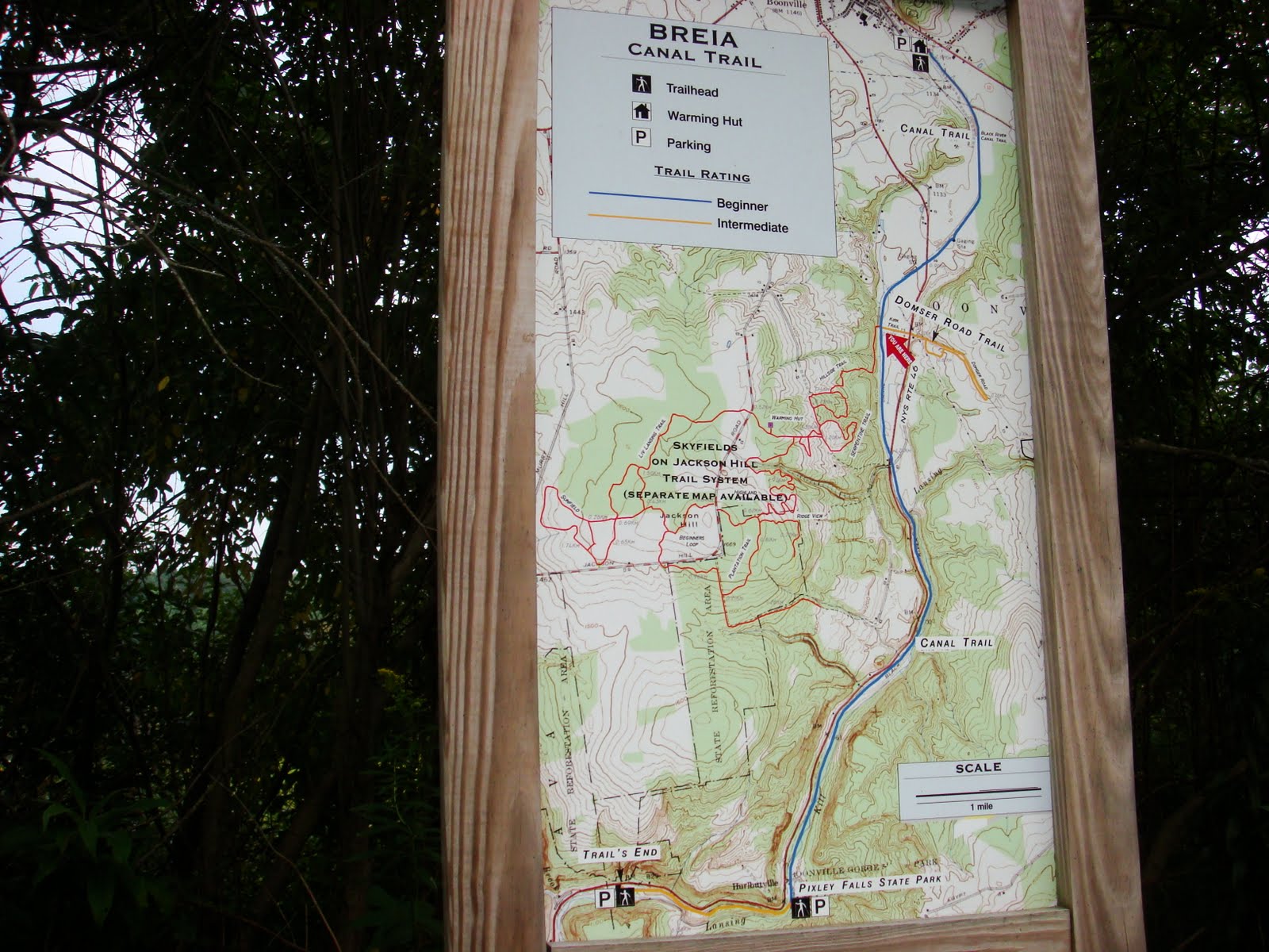
The Skyfields Trail system is said to offer the "finest views and the most spectacular landscapes" of the 3 BREIA trail systems. Today was not the day to enjoy these views. With a lot of area to cover, as seen on the map, we will have to spend more time here in the future...when it's not raining.

Monday, October 4, 2010

Alder Creek Gorge Trails

One fine afternoon in mid-September, we decided to go for a short hike on one of the Egypt Road trails. A cross-country ski trail owned and maintained by BREIA, it is open for hiking and biking in the summer. We have done one of the hikes here before but this time, we went to the second parking lot which is about 1 3/4 mile on the right after making the turn from Route 12 in Alder Creek.

From the parking lot, we had to cross Egypt Road to take the Alder Creek Gorge trails (blue trail on the map).


The warming hut that provides shelter to cross-country skiers in the winter was closed for the season.


Following the sign , we quickly walked up the trail through a deciduous forest.  True to its name, the Rim Trail runs at the lip of the gorge which  unfortunately, we could not see because of the dense foliage.  Not until we reached a clearing aptly named the Adirondack Overlook were we able to see some view. With the valley below and the high peaks in the distant horizon, this would have been a fantastic scenery were it not  marred by the presence of the electrical lines right smack in the middle of the view.


From there, we followed the Moss Trail and doubled back to the Rim Trail.  With some more daylight remaining, we had time to read some of the markers along the trail describing the nearby vegetation as this patch of allegheny blackberries.
We were even able to go done one of the gullies (Gully II), a black diamond cross-country ski trail leading to the Creek View Trail. The climb back up to the Rim Trail was quite an aerobic workout.

This will certainly not be the last time we'll visit these trails.

Tuesday, September 7, 2010

A Bike Ride on the Black River Canal Towpath Trail

9/2/2010

From Boonville to Route 46...

After riding the Black River Canal Feeder Trail, it is but natural to continue onward to the Black River Canal Towpath which also is a cross-country ski trail maintained by BREIA. We have hiked parts of this trail before but today, we brought our bikes and started the ride from Boonville.

The Black River Canal has the record for the most number of locks per mile, 109 locks along its 35 mile course from Rome to Lyons Falls, NY.  The 25mile southern section from Rome to Boonville had 70 locks, rising 693 feet.  Riding this trail will not be a piece of cake.


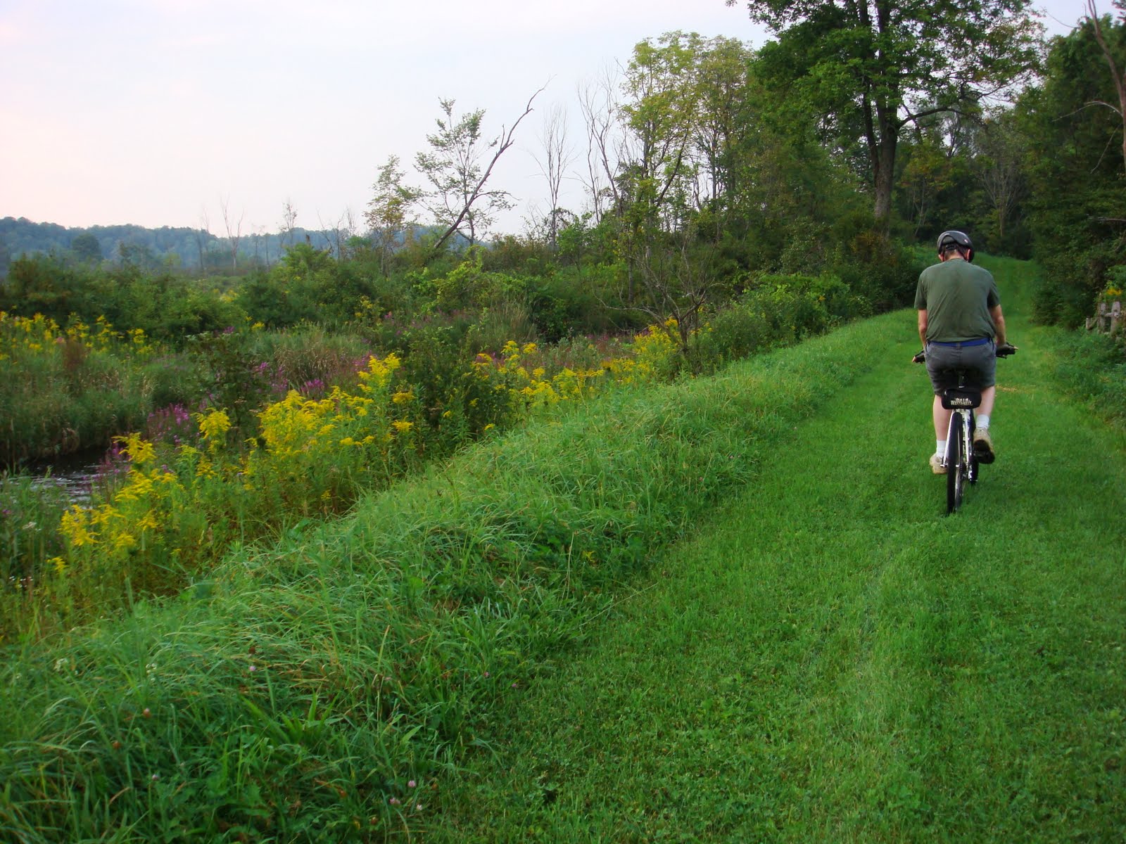
Heading south from Boonville, the grassy trail was fairly flat for about a mile, until lock number 70.  It was quite uneven though because of the numerous tree roots crossing the trails.


We crossed Route 46 and passed a few locks on the way.  Water rushing down the locks make for small waterfalls, like this one just across the Domser Road trail turnoff.


The mainly downhill ride was fairly easy.  Once we reached the other Route 46 intersection, we made our way back.  As expected, the uphill ride back was more strenuous, making it more difficult to outrun the mosquitoes patiently waiting for us on the trail.

Thursday, October 23, 2008

Pixley Falls State Park and the Black River Canal Towpath


The Black River Canal towpath begins in Boonville and ends below Pixley Falls State Park at the 5 combines. On one visit to the park, we decided to take the trail northwards.


The canal is now completely silted and barely discernable but remains of the old locks are still visible beside the trail. We counted 15 locks along 2.4 miles of gradual uphill climb. No wonder this canal has the record for the most number of locks. From Rome to Lyons Falls, NY, the Black River Canal had 109 locks over 35 miles, the summit being here in Boonville. In contrast, the Erie Canal only had 83 locks along its 350 mile course.


Thursday, September 4, 2008

Black River Canal walkway and towpath, Boonville NY

Whereas the Black River Canal was an avenue for commerce in the past, it is now principally a recreational venue. Volunteer organizations have been working to preserve sections of the canal for the public's enjoyment. Click here to see what the canal looks like today.


In Boonville, a new walkway lined with early 20th century street lights run south of the Main Street bridge. It features one of the few remaining Whipple bridges in existence. This bowstring cast-iron truss bridge that was patented in 1841 by Squire Whipple of Utica was eventually adopted by the Canal as the standardized bridge for canal crossings.


The canal walkway connects with a cross-country ski trail maintained by BREIA. Open for biking and hiking in the summer, this trail extends south along the towpath for 10 miles terminating below Pixley Falls State Park.


After a visit to the Black River Canal Museum, our group went on a short hike on this grassy trail that run alongside the canal.


This was lock no. 70. Obviously, the shed was not part of the operation.


This waste weir a little north of the lock served to drain excess water from the canal.


Along the way, we said hello to one of the natives.


Thursday, August 21, 2008

Egypt Road Trails


It's easy to find good hiking trails near Kayuta Lake. On Egypt Road, just 3/4 mile from Route 12 in Alder Creek is the Rail Track, one of the two trailheads for the Egypt Road Trails. This is one of the cross-country trails maintained by the Black River Environnmental Improvement Association (BREIA) which are open for hiking and biking in the summer.


Of the many trails one can take from this parking lot, we just decided to go hike in for about a mile.


The photographers in the group had fun taking pictures of the many varieties of mushrooms by the side of the path.