Monday, September 13, 2010

A Bike Ride on the Black River Canal Towpath Trail - Part 2


This time, we drove south about 1.8 miles from where we ended our bike ride last time, to a parking spot alongside Route 46.  Judging from the overgrown weeds, not that many people enter the trail through this gate.


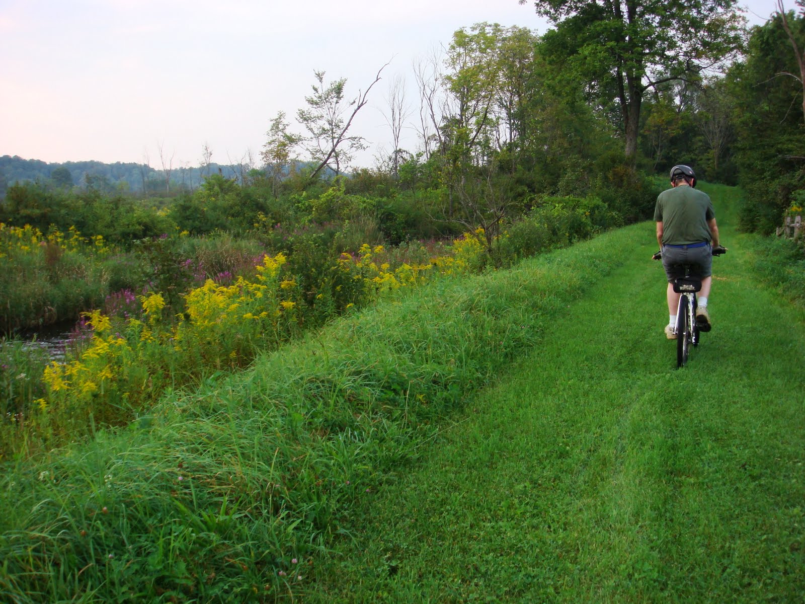
 Golden rods border the trail most of the way, interspersed by a variety of other wildflowers.  How much more beautiful it must be when all these flowers are at their peak.  The grassy trail appeared more manicured than most lawns this time of the year.


Below this partially barricaded bridge, the canal appears to have been dammed so that the water was now diverted downwards, forming the impressive Baker's Falls.  But more about that next time.

South of this point, the canal is mostly silted, overgrown with grasses and wildflowers.

Tuesday, September 7, 2010

A Bike Ride on the Black River Canal Towpath Trail

9/2/2010

From Boonville to Route 46...

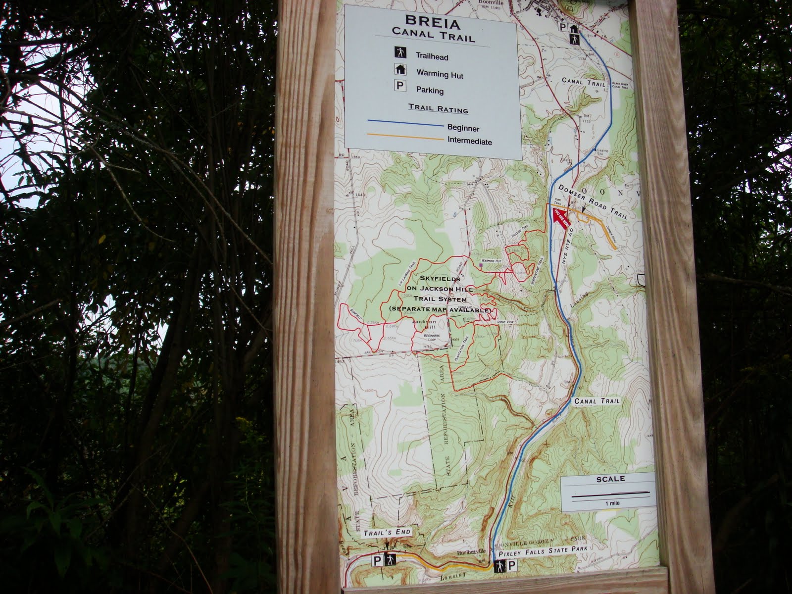
After riding the Black River Canal Feeder Trail, it is but natural to continue onward to the Black River Canal Towpath which also is a cross-country ski trail maintained by BREIA. We have hiked parts of this trail before but today, we brought our bikes and started the ride from Boonville.

The Black River Canal has the record for the most number of locks per mile, 109 locks along its 35 mile course from Rome to Lyons Falls, NY.  The 25mile southern section from Rome to Boonville had 70 locks, rising 693 feet.  Riding this trail will not be a piece of cake.


Heading south from Boonville, the grassy trail was fairly flat for about a mile, until lock number 70.  It was quite uneven though because of the numerous tree roots crossing the trails.


We crossed Route 46 and passed a few locks on the way.  Water rushing down the locks make for small waterfalls, like this one just across the Domser Road trail turnoff.


The mainly downhill ride was fairly easy.  Once we reached the other Route 46 intersection, we made our way back.  As expected, the uphill ride back was more strenuous, making it more difficult to outrun the mosquitoes patiently waiting for us on the trail.

Monday, August 2, 2010

A Bike Ride on the Black River Feeder Canal Trail - Part 3

 Boonville to Hawkensville Road
July 22, 2010


This time, we headed to Boonville, the end of the feeder trail.


At Erwin Park, a covered bridge crosses the canal close to the start of the trail.


The trail surface here appeared more even, making it easier to ride compared to  the 2 previous segments.  It's a popular walking and jogging path for residents nearby.

Although there were still some forested sections, plentiful wildflowers, birds, and butterflies (one of which seemed to follow me through the whole course), it was even less remote than the segment  from Edmonds Rd to Hawkensville. Some roads were visible beside the trail and there were no meadows to behold. The  trail was broken by several roads which we had to cross. 


It was a treat to see these kayakers who gave us a demonstration on how to cross under this low bridge on Sargent Road.


During our previous rides from Forestport and Edmonds Road, the feeder canal had been closely following the route of the Black River.  At about the Moose River Road crossover, the canal diverged from the river, going southward to Boonville while the Black River continued northward to Lake Ontario. This information I gathered looking at Mapquest's aerial map.


Three miles later, we reached our goal - the completion of the feeder canal bike trail.  It took us 3 days to ride the whole trail but hey, this was my first foray (not my husband's) into distance biking.

Next time, I hope to make this in one trip.

Monday, July 26, 2010

A Bike Ride on the Black River Feeder Canal Trail - Part 2

Edmonds Road to Hawkensville
July 20,2010

One late afternoon, we drove to Edmonds Road to continue our ride on the feeder canal trail.  The trail seems similar to the first section that we rode the other day.  But that was just at the beginning.


There were still some forested sections and wildflowers beside and on the trail, birds and butterflies buzzing by.


But  there were also expansive meadows, made beautiful  by early blooming golden rods.


Several homes border some sections (unexpected, since we had to cross several roads- Miller Woods, Williams, Hayes Rd E), the trail almost abutting their lawns.  Birdhouses are seen not just at the backyards but on the canal as well.


After 4miles, we reached Hawkensville Road, another signpost showing us the next leg to Boonville.  But it's getting late, we still have to ride back to Edmonds Rd, we haven't fully recovered from the recent long ride, etc., etc., so that will have to wait another day. 
Great Ride!
Sanity check:  If the trail is 10miles long, how come the sign says 3 miles to Boonville and 9 miles to Forestport? 

Monday, July 19, 2010

A bike ride on the Black River Feeder Canal Trail

Forestport to Edmonds Road
July 18,2010


The Black River Canal was intended to be a  feeder canal to the Erie Canal and to serve as a highway for goods from the North Country. From 1848 t0 1922, a 10 mile feeder canal from Forestport to Boonville in turn fed water to the Black River Canal.

Now, this feeder canal serves as a recreational venue which can be navigated by small canoes and kayaks. The Black River Feeder Canal Trail, the towpath that followed the canal, is now a part of the North Country National Scenic Trail and supposedly one of the prettiest canal trails in the conference.

One Sunday morning, I was coaxed into going for a ride on the towpath. With my last bike ride almost 2 years ago (maybe even longer) and not one longer than 2 miles,  I was quite skeptical about my ability to do this.


Nevertheless, onward  I went.  The first hurdle was Rt 28. Although this stretch of our route was merely 0.6 mile long,  it was my first venture on a major road on 2 wheels and completing that segment without a mishap was liberating.  After 3.1 miles of riding, we finally reached Canal Road in Forestport and the beginning of the towpath.


One and a half miles later, a road barrier. The trail is now off limits to motorized vehicles.  This must be the official start of the trail.


The trail was beautiful indeed.  As it meanders alongside the canal, tall hemlocks border its opposite side, almost hiding the steep slope going down to the Black River.  Wildflowers, birds, lily pads, tall grasses on the canal provide convenient sightseeing excuses to rest our butts.  Not to mention my aching knees, quads and my carpal tunnelled wrists.

How close did we get to Boonville?


 Apparently, not close enough.  At the Edmonds Road crossing, this sign showed just how much we've overestimated our progress. So far, we have ridden about 7.6 miles and we all decided to head back home.  Hawkensville and Boonville will have to wait for another time.